Navigation
GRIT resources are in the form of GPX and KML maps. These downloadable maps are designed for use on a dedicated GPS device or a mobile phone with GPS capabilities.
Basic Requiremement
GPS Device or Phone with compatible maps loaded.
Choose your GPS device with updated India maps as per your choice. Or download map based apps on your Android or iOS phone which offer capabilities of uploading a GPX or KML map for navigation.
Suggested GPS devices;
- Garmin GPS Map device (any model that mounts on the motorcycle)
- Garmin 64s (with motorcycle mount)
- Garmin Montana (with motorcycle mount)
- Trailtech Voyager
Android phone with motorcycle mount
Suggested Apps for Android
- Maps.me
- BikeGPX
Instructions
How to Use the GRIT Trails
GPS Device
After downloading the KML/GPX track onto your computer, you will have to use the provided GPS software(eg:Garmin uses Basecamp) to import tracks to GPS device. We recommend you have an India map preloaded on your GPS device.
Mobile Phone
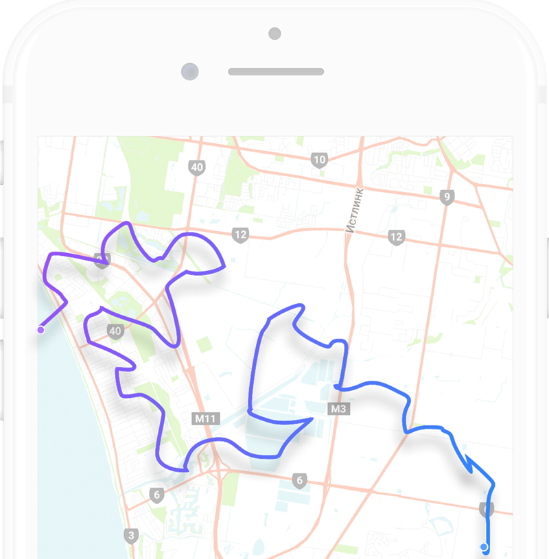
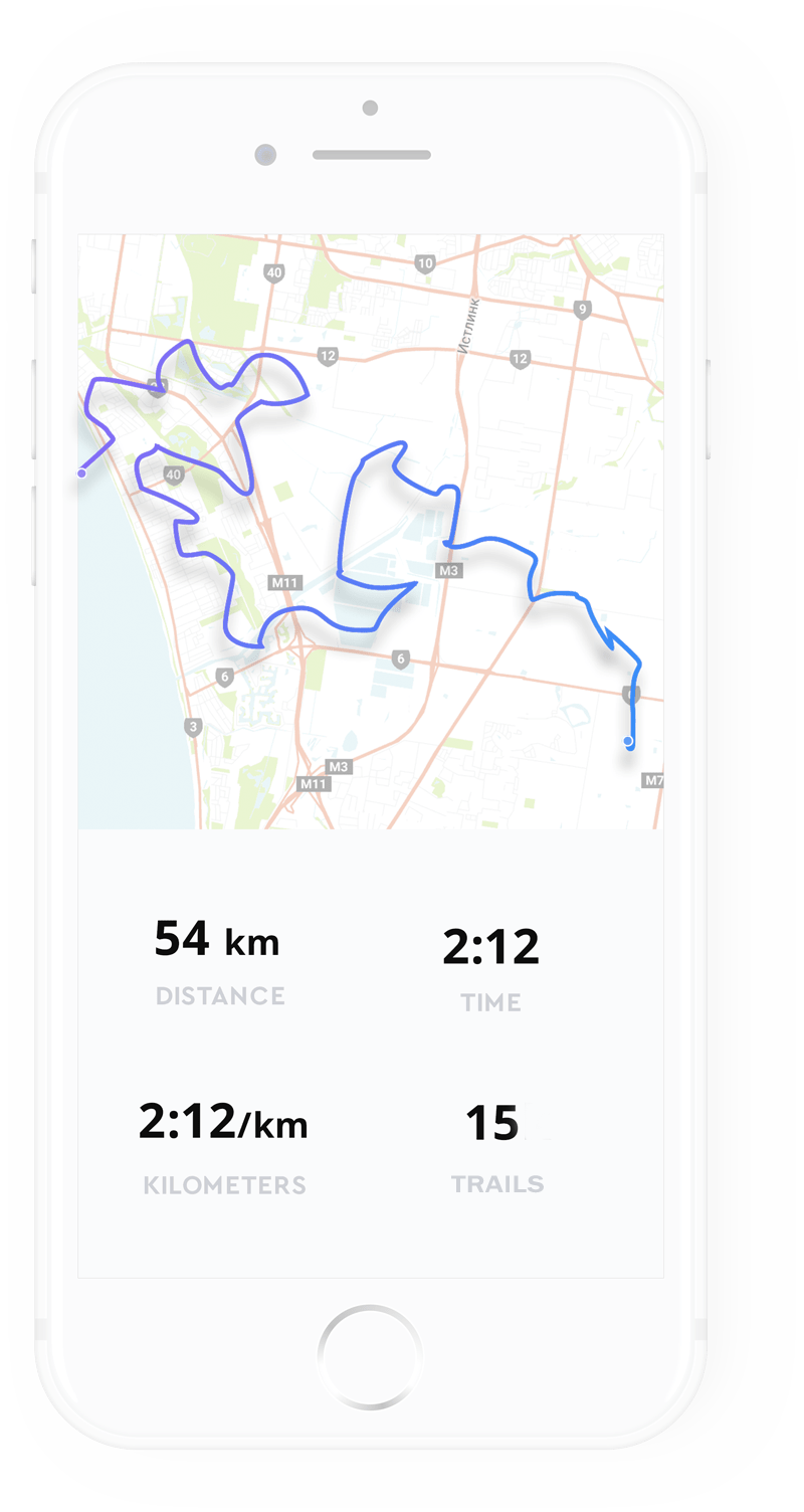
After downloading the KML/GPX onto your device, open the file in the associated mapping app. The Route will show up as a track marked clearly on the map.
Follow this route to start riding the GRIT.
Note:- Mapping apps will have a navigation or route record option to prevent the screen from going to sleep while on the trail. We recommend a power source for your device as constant GPS usage can drain your battery.
To explore the routes on the GRIT, head on over to the Routes section!
Find out what goes into creating the GRIT, learn more about us!